
English| EUR
Suggested for you
More currencies
Choose a language
Mount Tarawera remains one of New Zealand's most restricted natural landmarks. Independent hiking is not permitted on this sacred volcano, and all access requires participation in a licensed guided tour. Understanding these rules prevents wasted travel and helps you plan a legitimate visit.
Quick answer
Independent hiking on Mount Tarawera is strictly prohibited. The volcano sits on private land within the Tarawera Conservation Estate and is sacred to Te Arawa iwi. All visitors must book a guided tour with an authorized operator. No public trails exist, and attempting to hike without a guide constitutes trespassing. Guided tours typically depart from Rotorua and include crater rim access with cultural interpretation.
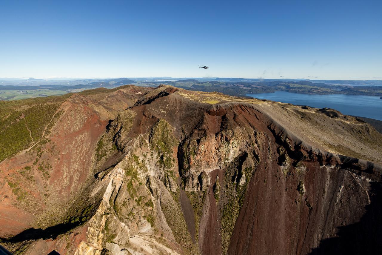
Mount Tarawera erupted violently in 1886, burying three villages and reshaping the Rotorua landscape in a single night. The eruption created a seventeen-kilometer rift through the mountain, leaving behind a dramatic crater system that draws thousands of visitors each year. What most travelers discover only after arriving in Rotorua is that the volcano operates under access restrictions that eliminate the possibility of solo exploration. The land belongs to Te Arawa, the Māori iwi whose ancestors witnessed the eruption and whose villages were destroyed in the catastrophe. Since 2011, access has been managed through a limited number of licensed tour operators who hold exclusive permits. These operators provide the only legal pathway to the crater rim and volcanic domes. No public roads reach the summit, and the private track system remains gated at multiple points. Hiking Mount Tarawera independently is not a matter of finding an unmarked trailhead or arriving early—the infrastructure for self-guided visits does not exist. The restrictions reflect both cultural protocol and conservation priorities. Te Arawa regard Tarawera as tapu, a site of spiritual significance where traditional practices continue. Guided tours incorporate this perspective, offering context that transforms the visit from a summit hike into an encounter with living history. Operators share oral accounts of the 1886 eruption, explain the formation of Red Crater and the Rotomahana geothermal system, and provide access to viewpoints across Lake Tarawera and the Kaingaroa Forest. Visitors who arrive expecting a standard backcountry hike often find the guided format restrictive, but the alternative—no access at all—clarifies the trade-off. Tour groups typically number between six and twelve people, and most operators limit crater rim time to between forty-five minutes and an hour. The experience centers on interpretation rather than endurance. You walk across black sand deposits, stand above the rift zone, and return to Rotorua within four hours. For travelers accustomed to unrestricted trail systems, this model requires adjustment, but it remains the only legal method to reach the summit of one of New Zealand's most historically significant volcanoes.
“No public trails exist, and the private track system remains gated at multiple points.”
Access to Mount Tarawera is restricted to private land under the guardianship of Ruawahia 38 Trust. Consequently, independent hiking is not permitted.
Verdict: The entrance fee for independent hikers is 0 NZD because public access is prohibited; visitors must book a paid guided tour to gain entry.
Mount Tarawera is located in the Rotorua region of New Zealand. Because the mountain is situated on private Māori land, independent access is restricted, and transportation is coordinated through authorized tour operators.
Drive via Tarawera Road from Rotorua city center
Operator-provided transport from Rotorua
Visitors should arrive at the designated meeting point specified by their tour operator. Please note that independent hiking is not permitted, so you must travel with your booked tour group to reach the site.
The optimal time to visit Mount Tarawera is during the shoulder months of March to May or September to November, when conditions are stable and visibility is high. Because independent hiking is not permitted, all visitors must align their schedule with the availability of licensed guided tours.
Warm, average 18°C–24°C. High UV levels.
Expect clear skies but book several weeks ahead to secure a spot.
Mild, average 12°C–18°C. Frequent clear days.
Stable weather patterns make this a reliable season for crater visibility.
Cold, average 5°C–12°C. Risk of frost or snow.
Lower temperatures require proper gear, though tours remain consistent if weather permits.
Variable, average 10°C–16°C. Windy conditions possible.
Spring offers a balance of daylight hours and manageable temperatures for the ascent.
Verdict: The best window is during the shoulder months of March to May, provided tours are booked well in advance.
Access to Mount Tarawera is strictly via guided tours, so preparation focuses on gear and booking confirmation.
Everything you need to know about mount tarawera hike without guide
No, you cannot attempt a mount tarawera hike without guide as the land is privately owned. Access to the summit and surrounding volcanic terrain is strictly controlled to protect the site.
It is not a legal option to hike this area independently. The mountain is situated on private Maori land, and unauthorized entry is prohibited by law.
There are no public, self-guided tracks available for those seeking a mount tarawera hike without guide. All visitors must be accompanied by an authorized guide to enter the area.
Attempting to enter the area without authorization may result in trespassing charges. Visitors must book a professional tour to experience the volcanic crater and unique landscape.
You can only access the mountain through registered, paid guided tours. These providers manage transport and land access permits on behalf of the local iwi.
Yes, the entire volcanic site is restricted to the public to ensure safety and cultural preservation. This policy maintains the integrity of the geological formations and protected areas.
Yes, guided tours provide the only authorized access to the summit. These experts offer detailed insights into the 1886 eruption, the surrounding rhyolite domes, and the unique alpine environment.